I left Monticello BLM and Valley of the Gods in a hurry. The sky had turned cloudy and gray, and I could feel the cold creeping in. Valley of the Gods is a 17-mile dirt road through sandstone buttes and mesas, sort of a smaller cousin to Monument Valley. The Navajo once called this stretch Tsé Biiʼ Ndzisgaii—“Valley of the Rocks.” Even though it’s not as famous as Monument Valley, Hollywood has used the backdrop for westerns since the 1940s. Driving through it at 10 miles an hour felt like a slow-motion ride across history.

Mexican Hat
Not long after, I rolled past Mexican Hat. There’s not much to say—it looks like a Mexican sombrero perched on a pedestal of sandstone, and that’s exactly how the town got its name back in 1882. Prospectors passing through noticed the odd-shaped rock formation and stuck the name on the map. Today it’s a dot on the highway, but a memorable one.

The Forrest Gump Point
I kept driving, knowing I was getting close to Monument Valley. Sure enough, I came up on that scene—the stretch of U.S. 163 where Forrest Gump stops running and decides to head home. There were signs, pull-offs, cars everywhere, and plenty of folks doing their own Forrest Gump runs. I don’t usually go for the touristy reenactments, but hey, when in Rome. I did my best Forrest Gump impression, selfie-style, just for my wife and friends. Monument Valley loomed off in the distance, every bit as iconic as you’d imagine.

This land is sacred to the Navajo, and it’s been featured in more movies than you can count—John Ford westerns, Stagecoach, The Searchers, and of course Forrest Gump. Seeing it in person felt like stepping into a postcard.
Pushing Toward Arizona
The road stretched on. I was tempted to stop every few minutes for photos, but I was racing daylight. Driving after dark out here is risky—wild animals, slick roads, and more than a few junk drivers. I pulled over now and then for a quick shot, but mostly kept rolling.

A burger from my previous visit. Green chile. It was way better than the picture lets off.

I eventually topped off at Cameron Trading Post, a roadside stop with real history. It opened in 1916 as a place where Navajo and Hopi locals traded wool, blankets, and livestock for dry goods. Today it’s a mix of diner, motel, and big souvenir shop. Years back, my wife and I stopped here and had one of the best burgers of our travels. This time, I stuck to frozen halibut and dim sum in the van, but just walking the grounds brought back memories.

Dangerous Drive to Sedona
The stretch between Monument Valley and Sedona got sketchy fast. Climbing in elevation, the rain turned to hail, then snow. By the time I was winding down the mountain roads into Sedona, I was crawling along at 30 mph. Finally rolled into the RV park around 10 p.m.—the only RV park in town, which meant lots of rules. No noise after 10, no wandering around outside. I kept quiet, hooked up the sewer line, and called it a night. Rancho Sedona RV Park

Sedona: Red Rock Country
Woke up safe, grateful, and greeted by a bluebird day. Sedona feels like Zion National Park mashed with a ski town—red rock formations all around, but also galleries, resorts, and crowds. It’s beautiful, no doubt about it, even if a little touristy for my taste.

Airport Mesa

First stop was Airport Mesa, perched on a bluff above town. Locals call it one of Sedona’s “energy vortex” sites, where the earth is said to radiate special spiritual power. Whether you buy into that or not, the views are unreal. Red rock buttes, green junipers, and snow-dusted peaks in the distance.

Chapel of the Holy Cross

Next was the Chapel of the Holy Cross, built right into the red cliffs in 1956. A local rancher named Marguerite Brunswig Staude, inspired by the Empire State Building of all things, commissioned it. Frank Lloyd Wright’s son helped with the design. The result is a modernist Catholic chapel that looks like it grew straight out of the sandstone. Even for a non-religious guy, it felt like a holy moment standing there, the stained glass glowing against the desert sun.

Parking, though—total nightmare. I lucked into a spot, hiked up the hill, and later scored a golf cart ride back down.

Red Rock Trails

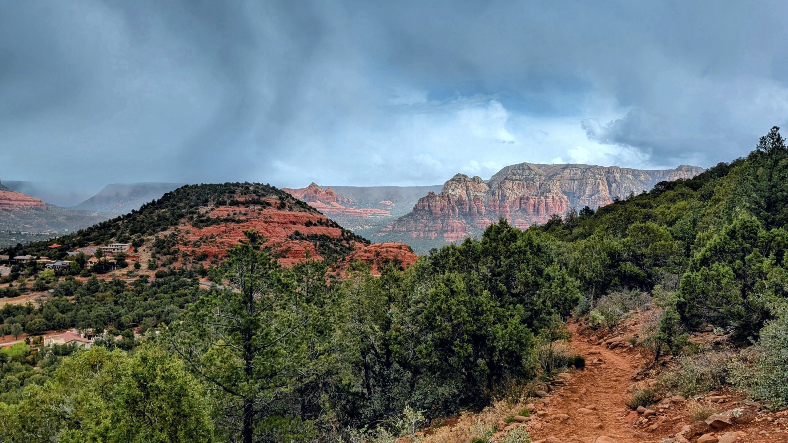
With my knees still stiff but craving movement, I took on one of Sedona’s Red Rock trails. A few miles of ups and downs, nothing too gnarly, but enough to get the blood flowing. The mix of red stone and green desert shrubs gave the hike a lusher feel compared to the stark rock spires of Valley of the Gods. I was one of the only folks out there, which made it all the better.
Tlaquepaque

Back in town, I stopped at Tlaquepaque (pronounced “Tlah-keh-PAH-keh”). It looks old-world, like something lifted from a Mexican village, but it was actually built in the 1970s as an arts-and-crafts shopping plaza. Arched doorways, stucco walls, fountains, and courtyards—it’s designed to feel like a centuries-old market square. My wife would have loved poking around the little boutiques. I just window-shopped and grabbed groceries for a salad dinner back at the van.

Even though I’ve had zero Mexican food on this trip, I have been adding a lot of avocado and broken up tortilla chips to my salads, and it’s been a delicious addition.
Onward
Sedona had been a wild ride—snow, red rocks, chapels, trails, and tacos I didn’t eat. The next morning, I rolled out, headed east toward Petrified Forest National Park. On the map, it didn’t look like much, but I was in for a surprise.
Check out the next part of this driven drive here:
Check out the previous leg here:
Leave a Reply